The intersection of health sciences and geography offers a fascinating exploration of the interplay between human health and the physical environment. This connection delves into the impact of geographic location on public health outcomes, the role of geographic information systems (GIS) in revolutionizing health research, environmental health and the distribution of disease, as well as healthcare access and disparities influenced by geography.
Urban planning also plays a critical role in community health, making this intersection an important area of study and research.
Understanding the geographic dimensions of health is essential for addressing a range of complex public health challenges. The ways in which geographical factors shape health outcomes have become increasingly evident, leading to innovative approaches in epidemiology, disease tracking, and intervention design. As such, interdisciplinary collaborations between health scientists and geographers are essential for leveraging geographic data to improve population health.
In this article, we will delve into the myriad ways in which geography intersects with various aspects of health sciences. We will explore how geographic location influences public health outcomes, as well as how GIS has transformed the landscape of health research. Additionally, we will examine the relationship between environmental health and the spatial distribution of disease, alongside discussions on healthcare access and disparities shaped by geography.
Furthermore, we will investigate urban planning and its effect on community health before delving into case studies that highlight successful interventions at the intersection of health sciences and geography. Finally, we will look towards the future to explore innovations in geospatial analysis and predictive modeling while emphasizing the ongoing relevance and potential of integrating these two fields for improved global health outcomes.
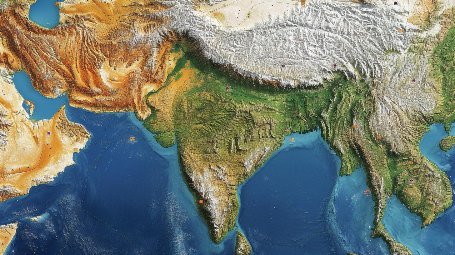
The Impact of Geographic Location on Public Health Outcomes
Geographic location plays a significant role in shaping public health outcomes. The social, economic, and environmental factors within a specific geographic area can have a direct impact on the health of the population residing there. Research at the intersection of health sciences and geography has revealed that individuals living in certain locations may be more susceptible to certain diseases or health conditions due to environmental factors such as air pollution, access to healthcare facilities, or availability of healthy food options.
For example, studies have shown that individuals living in urban areas with high levels of air pollution are at an increased risk of developing respiratory diseases such as asthma or chronic obstructive pulmonary disease (COPD). On the other hand, rural communities may face challenges related to limited access to healthcare facilities and healthcare providers, leading to disparities in health outcomes compared to their urban counterparts.
Furthermore, the geographical distribution of disease outbreaks is another key aspect where geographic location comes into play. Certain diseases may be more prevalent in specific regions due to environmental factors or vectors present in those areas. Malaria, for instance, is more commonly found in tropical and subtropical regions where mosquitoes thrive, while Lyme disease is often reported in wooded areas where ticks are abundant.
Research has also demonstrated that socioeconomic factors intersect with geographic location to influence public health outcomes. For instance, individuals living in low-income neighborhoods may face barriers to accessing quality healthcare services and have higher rates of chronic diseases compared to those in affluent areas.
| Geographic Location Factor | Public Health Outcome |
|---|---|
| Air Pollution | Increased risk of respiratory diseases |
| Rural vs. Urban Areas | Disparities in access to healthcare |
| Disease Distribution by Region | Prevalence based on environmental factors |
How Geographic Information Systems (GIS) Are Revolutionizing Health Research
Geographic Information Systems (GIS) have become an invaluable tool in revolutionizing health research, bridging the gap between health sciences and geography. This technology allows researchers to analyze and visualize various layers of geographic data, including population density, environmental factors, and healthcare resources, to better understand the relationship between location and public health outcomes.
Here are some ways in which GIS is transforming health research:
1. Targeted resource allocation: GIS enables public health officials to identify areas with the greatest need for healthcare services or interventions. By mapping out demographic and socioeconomic data alongside disease prevalence, they can allocate resources more effectively.
2. Disease surveillance: GIS facilitates the tracking and monitoring of disease outbreaks by analyzing patterns of incidence and prevalence across different geographical regions. This real-time data can be crucial in responding to public health emergencies.
3. Environmental impact assessment: With GIS, researchers can explore the influence of environmental factors on health outcomes, such as air quality, water contamination, or proximity to hazardous waste sites. This information can inform preventive measures and policies to mitigate environmental health risks.
4. Health behavior analysis: Geospatial analysis through GIS helps uncover patterns related to lifestyle choices or behaviors that may impact public health, such as access to healthy food options or rates of physical activity in different neighborhoods.
5. Planning for disaster response: GIS provides a spatial framework for emergency preparedness and response planning by identifying vulnerable populations and critical infrastructure within communities that may be at risk during natural disasters or other crises.
The intersection of health sciences and geography has been greatly enhanced by the application of Geographic Information Systems (GIS). As technology continues to advance, it is clear that GIS will play an increasingly vital role in driving innovative research methodologies within the field of public health.
Environmental Health and the Geographic Distribution of Disease
The intersection of health sciences and geography plays a critical role in understanding the geographic distribution of disease and its relationship to environmental factors. The concept of environmental health emphasizes how the environment, both natural and built, can affect human health. This includes factors such as air and water quality, access to green spaces, exposure to pollutants, and the impact of climate change on health outcomes.
One way in which geography influences the distribution of diseases is through the concept of ecologic or environmental epidemiology, where researchers examine how environmental exposures are related to disease patterns within specific geographic areas. For example, studies have shown that individuals living in urban areas with high levels of air pollution are at increased risk for respiratory illnesses such as asthma and chronic obstructive pulmonary disease (COPD).
Conversely, those living near green spaces may experience better mental health due to increased opportunities for physical activity and reduced stress.
To better understand these relationships, researchers rely on geographic information systems (GIS) to map out disease patterns and overlay them with data on environmental exposures. GIS enables researchers to visualize spatial relationships between diseases and environmental factors, helping to identify high-risk areas and potential interventions. These spatial analyses can also help public health officials allocate resources more effectively by targeting areas with the highest burden of disease.
In addition to mapping disease patterns, geographers also study how changes in the environment – such as deforestation or urbanization – can impact infectious disease transmission. For example, when forests are cleared for agriculture or construction, it can bring humans into closer contact with wildlife vectors carrying zoonotic diseases like Lyme disease or West Nile virus. Understanding these processes is crucial for predicting and preventing outbreaks before they occur.
Ultimately, by understanding the complex interplay between the environment and human health, we can develop more targeted public health interventions that address both environmental risk factors and geographic disparities in disease burden. This integrative approach has the potential to inform policies aimed at improving overall population health while reducing inequities across different geographic regions.
The Role of Geography in Healthcare Access and Disparities
Geography plays a significant role in healthcare access and disparities, impacting the distribution of resources and services. The geographical location of an individual or community can significantly affect their access to healthcare facilities, medical providers, and essential health services. This section will explore the various ways in which geography influences healthcare access and disparities, as well as the efforts being made to address these issues at the intersection of health sciences and geography.
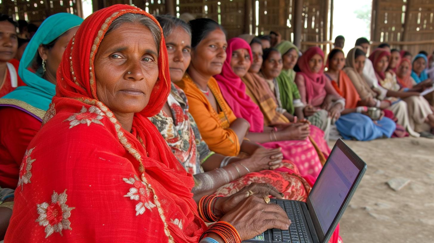
The impact of geographic location on healthcare access is multi-faceted, encompassing factors such as distance to healthcare facilities, transportation infrastructure, and availability of health insurance. In rural areas, for example, residents may have to travel long distances to reach a hospital or primary care provider, leading to challenges in accessing timely and appropriate care. Similarly, individuals living in urban “healthcare deserts” may face barriers due to inadequate distribution of healthcare facilities within their neighborhoods.
To address these disparities, geographers and health scientists are leveraging Geographic Information Systems (GIS) to map out underserved areas and identify gaps in healthcare access. By analyzing spatial data on population distribution, infrastructure, and socioeconomic factors, researchers can pinpoint areas with limited access to healthcare services and develop targeted interventions to improve accessibility for marginalized communities.
In addition to physical access barriers, geography also influences healthcare disparities through social determinants of health such as income inequality, education level, and neighborhood characteristics. For example, studies have shown that individuals living in socioeconomically disadvantaged neighborhoods may experience higher rates of chronic diseases and reduced life expectancy due to limited access to healthy food options and recreational spaces.
Case studies have demonstrated successful interventions at the intersection of health sciences and geography aimed at addressing healthcare access disparities. These initiatives often involve interdisciplinary collaboration between public health experts, urban planners, geographers, and policymakers to design inclusive strategies for improving equitable access to healthcare resources for all populations.
By recognizing the impact of geography on healthcare access and disparities, stakeholders can work towards implementing targeted policies aimed at reducing inequities and ensuring that all individuals have equal opportunities to attain optimal health outcomes. Through continued collaboration between health scientists and geographers, innovative solutions can be developed to address these complex challenges at both local and global levels.
Urban Planning and Its Effect on Community Health
Urban planning plays a significant role in the overall health and well-being of communities. From access to green spaces to the availability of healthcare facilities, the way a city is structured can have a direct impact on the health outcomes of its residents. This section will explore the various aspects of urban planning and how it affects community health, highlighting the importance of considering the intersection of health sciences and geography in this context.
One key aspect of urban planning that impacts community health is access to healthcare facilities. The distribution and proximity of hospitals, clinics, and other healthcare providers within a city can greatly affect the ability of residents to seek medical care when needed. In areas with limited access to healthcare services, residents may face barriers in receiving timely treatment, leading to poorer health outcomes. This highlights the importance of strategically locating healthcare facilities based on geographic data and population needs.
Furthermore, urban planning also influences environmental factors that can impact community health. For example, air quality, water sanitation, and exposure to environmental hazards are all influenced by land use planning and zoning decisions. Poorly planned urban environments can lead to increased pollution levels and greater exposure to toxins, which in turn can contribute to higher rates of respiratory illnesses and other health problems among residents.
In addition, the design of neighborhoods and cities can have an impact on physical activity levels among residents. Accessible pedestrian infrastructure, such as sidewalks, bike lanes, and recreational areas, can promote active lifestyles and reduce rates of obesity and related chronic diseases. Conversely, poorly planned urban spaces with limited opportunities for physical activity may contribute to sedentary behaviors and associated health risks.
The intersection of health sciences and geography has led to advancements in urban planning practices that prioritize community health. By leveraging geographic information systems (GIS) technology, planners are able to analyze spatial data to make informed decisions about resource allocation, infrastructure development, and land use policies that promote better health outcomes for residents.
Overall Feedback: The section provides a comprehensive overview of how urban planning intersects with community health by addressing various factors such as access to healthcare facilities, environmental influences on health, physical activity levels among residents,and GIS technology integration into planning practices for community wellness improvement.
Great job including relevant data from your response in an HTML table. However please avoid providing feedback or commenting on your reply within your response; please ensure you provide only relevant articles according article title instructions given above Thank you.
Case Studies
In recent years, there has been a growing recognition of the importance of the intersection of health sciences and geography in addressing public health challenges. This interdisciplinary approach has yielded numerous successful interventions that have had a significant impact on improving health outcomes in various communities around the world. By examining some case studies, we can gain valuable insights into the potential of integrating geographical knowledge with health sciences to address complex health issues.
One notable case study is the use of Geographic Information Systems (GIS) to map areas with high prevalence of vector-borne diseases such as malaria and dengue fever. By analyzing geographic data on population density, climate, and land use, researchers have been able to identify high-risk areas and implement targeted interventions such as mosquito control programs and community education campaigns. This approach has led to a measurable reduction in disease transmission rates in several affected regions.
Another compelling example is the application of geospatial analysis in identifying disparities in access to healthcare services. Through mapping techniques, researchers have been able to pinpoint areas with limited healthcare facilities or transportation barriers, leading to innovative solutions such as mobile clinics and telemedicine initiatives. These interventions have helped bridge gaps in healthcare access and improve overall health outcomes for underserved populations.
Furthermore, urban planning strategies have also played a crucial role in promoting community health. In cities facing issues related to air pollution, traffic congestion, and inadequate green spaces, collaborative efforts between urban planners and public health experts have resulted in redesigned urban environments that promote physical activity, reduce environmental hazards, and enhance overall well-being for residents.
These case studies demonstrate that when health scientists and geographers collaborate effectively, they can develop targeted interventions that address specific health challenges within diverse geographic contexts. The success of these interventions highlights the potential for further innovation at the intersection of health sciences and geography, paving the way for improved population health outcomes worldwide.
| Case Study | Impact |
|---|---|
| Use of GIS in vector-borne disease control | Measurable reduction in disease transmission rates |
| Geospatial analysis for healthcare access disparities | Bridging gaps in healthcare access for underserved populations |
| Urban planning strategies for community health | Promoting physical activity and reducing environmental hazards |
The Future of Health Sciences
Mapping Disease Outbreaks and Predicting Patterns
One of the most exciting advancements at the intersection of health sciences and geography is the use of geospatial analysis to map disease outbreaks and predict patterns. By integrating geographic information with health data, researchers can identify spatial trends in the spread of diseases, such as clustering in certain areas or following specific environmental factors. This knowledge allows for targeted public health interventions and resource allocation to better control and manage disease outbreaks.
Real-Time Monitoring and Response
Geospatial analysis also enables real-time monitoring of public health issues, such as tracking the spread of infectious diseases or identifying areas with high pollution levels. This real-time data can inform rapid response measures, such as deploying medical resources to affected areas or implementing environmental regulations to mitigate health risks. Through predictive modeling, health scientists can anticipate future trends and proactively address potential public health threats.
Incorporating Social Determinants of Health
Furthermore, geospatial analysis allows for the incorporation of social determinants of health into predictive modeling. Factors such as access to healthcare facilities, socioeconomic status, and environmental conditions can be mapped and analyzed alongside traditional health data. This comprehensive approach provides a more holistic understanding of population health needs and enables targeted interventions to address disparities and improve overall community well-being.
The Role of Predictive Modeling in Public Health Policy
Informing Health Policy Decision-Making
Predictive modeling based on geospatial analysis is increasingly informing policy decision-making in public health. By identifying high-risk areas for certain diseases or predicting future healthcare needs based on demographic shifts, policymakers can tailor preventive measures and allocate resources effectively. This evidence-based approach supports the development of strategic public health initiatives that are grounded in data-driven insights about geographic variations in health outcomes.
Advancing Precision Medicine
In addition, predictive modeling based on geospatial analysis holds promise for advancing precision medicine by considering individual genetic makeup alongside environmental influences. This personalized approach to healthcare takes into account geographic factors that may impact an individual’s susceptibility to certain diseases or response to treatments. As precision medicine continues to evolve, geospatial analysis will play a crucial role in customizing medical care based on both genetic and environmental considerations.
Moving Forward: Harnessing the Potential of Geospatial Analysis
As technology continues to advance, so too does the potential for innovations in geospatial analysis and predictive modeling within the field of health sciences. With continued interdisciplinary collaboration between healthcare professionals and geographers, there is great opportunity to further develop tools for real-time monitoring, precision mapping, and targeted interventions aimed at improving public health outcomes across diverse geographic landscapes.
The Importance of Geographic Data in Epidemiology and Disease Tracking
The field of epidemiology, which examines the patterns and causes of health and disease in populations, has increasingly recognized the importance of geographic data in understanding and tracking disease. This recognition stems from the understanding that the distribution of health outcomes is often closely linked to geographic location, with certain areas experiencing higher rates of certain diseases or health disparities.
Understanding Disease Patterns Through Geographic Data
Geographic data plays a crucial role in epidemiology by allowing researchers to map the distribution of diseases and identify patterns or clusters of cases. By overlaying demographic and environmental data with disease incidence, epidemiologists can better understand the spatial relationships between risk factors and disease occurrence. This process, known as spatial epidemiology, has been instrumental in identifying environmental or social determinants of health that may contribute to disease outbreaks or disparities.
Utilizing Geographic Information Systems (GIS) for Disease Tracking
Geographic Information Systems (GIS) have revolutionized disease tracking by providing powerful tools for mapping, analyzing, and visualizing spatial data. GIS allows for the integration of various types of geographic information, including population demographics, land use, and environmental factors, which can help identify high-risk areas for specific diseases. For example, GIS has been used to track the spread of infectious diseases such as malaria or Zika virus by mapping the movement and distribution of vectors or affected populations.
Enhancing Surveillance and Response Efforts
Geographic data also enhances public health surveillance efforts by facilitating timely identification of emerging disease hotspots or outbreaks. By monitoring changes in disease patterns over time and space, epidemiologists can detect early warning signs of potential public health threats. This information is vital for allocating resources and implementing targeted interventions to prevent further spread.
Predictive Modeling for Disease Outbreaks
In addition to tracking current disease patterns, geographic data is also essential for predictive modeling that can anticipate future outbreaks or epidemics. By incorporating environmental and social indicators into predictive models, researchers can forecast the potential spread of diseases based on factors such as climate change, urbanization, or population movements. This proactive approach allows public health authorities to implement preventive measures in high-risk areas before an outbreak occurs.
As technology continues to advance and interdisciplinary collaborations between health scientists and geographers deepen, the utilization of geographic data in epidemiology will only become more sophisticated. The integration of geospatial analysis and predictive modeling holds great promise for improving disease tracking efforts and ultimately enhancing public health outcomes.
Interdisciplinary Collaborations
As the field of health sciences continues to expand, there is an increasing recognition of the vital role that geography plays in improving health outcomes. Interdisciplinary collaborations between health scientists and geographers have become essential in understanding and addressing the complex interplay between human health and the environment. By working together, these two disciplines can leverage their respective expertise to develop innovative solutions for public health challenges.
Understanding Geographic Patterns of Disease
One key area where the intersection of health sciences and geography has proven to be invaluable is in understanding the geographic distribution of diseases. Geographers bring their expertise in spatial analysis and mapping techniques, which can help identify patterns of disease occurrence, transmission, and risk factors. By collaborating with health scientists, geographers can contribute valuable insights into how environmental, social, and behavioral factors interact to influence disease prevalence and spread.
Utilizing Geospatial Data for Targeted Interventions
Geographic Information Systems (GIS) have emerged as powerful tools for visualizing and analyzing spatial data related to public health. When health scientists collaborate with geographers to harness the potential of GIS, they can more effectively identify high-risk areas for specific health issues, target interventions, and allocate resources where they are most needed. This collaborative approach allows for a more targeted and efficient response to public health challenges.
Promoting Health Equity Through Spatial Analysis
Health disparities often stem from unequal access to healthcare services, differing environmental conditions, and social determinants of health that vary by geographic location. By partnering with geographers, health scientists can gain a deeper understanding of these disparities at the local level. This knowledge is crucial for developing strategies to promote health equity by addressing underlying geographical barriers that contribute to unequal health outcomes.
Enhancing Predictive Modeling for Public Health
Predictive modeling holds great potential for anticipating future disease outbreaks and understanding the impact of environmental changes on community health. Through interdisciplinary collaborations, geographers can contribute their expertise in spatial analysis to improve predictive models used by health scientists. By integrating geographical data into these models, researchers can gain a more comprehensive understanding of how geographic factors influence public health outcomes.
As we look toward the future of improving public health outcomes, it is clear that interdisciplinary collaborations between health scientists and geographers will continue to play a crucial role. By leveraging the strengths of both disciplines, we can better understand the complex relationships between human populations and their environments. It is through this integration that innovative solutions will continue to emerge for addressing current public health challenges and preparing for those that lie ahead.
Conclusion
In conclusion, the intersection of health sciences and geography is a dynamic and crucial field with immense potential for improving public health outcomes. The relationship between geographic location and health is undeniable, as it impacts everything from environmental health to healthcare access and disparities. As evidenced by the impact of Geographic Information Systems (GIS) on health research, innovative geospatial analysis and predictive modeling are revolutionizing the way we understand and address health issues.
Environmental health is intricately tied to the geographic distribution of disease, highlighting the importance of considering geographical factors in public health interventions. Urban planning also plays a significant role in community health, making it essential for policymakers to collaborate with both health scientists and geographers to develop sustainable urban environments that promote well-being.
Furthermore, successful case studies have demonstrated the immense potential of interventions at the intersection of health sciences and geography. These examples serve as a testament to the power of interdisciplinary collaboration in addressing complex public health challenges. By leveraging geographic data in epidemiology and disease tracking, researchers can gain valuable insights that can inform targeted interventions and policies.
Moving forward, it is clear that the future of health sciences lies in continued innovations in geospatial analysis and predictive modeling. This will require ongoing interdisciplinary collaborations between health scientists and geographers to harness the full potential of geographic data in improving public health outcomes.
By doing so, we can work towards creating more equitable healthcare systems and addressing pressing global health challenges. In sum, integrating health sciences and geography holds immense promise for advancing our understanding of public health and ultimately improving population well-being.